Factors to consider when picking a route
Distance vs time
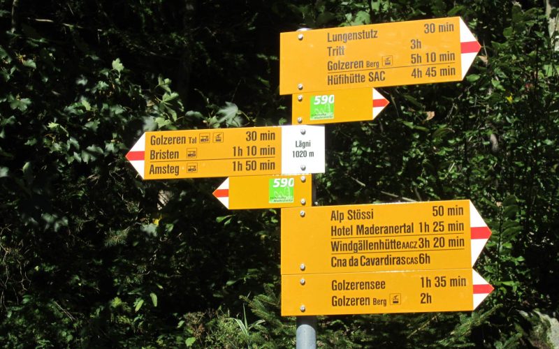
All Swiss hiking signs (such as the one in the image above) show times to the destination, rather than distance. This is because the distance of a route doesn’t give any real indication of how difficult it is, or how long it takes. There are a number of other factors that can influence how long it will take as well as how difficult the route will be, such as the difference in height,the type of trail (is it a narrow rocky ridge at altitude or a wide paved road between villages) and the terrain (valley floor versus high Alpine terrain). Note also that signposts, and route details on hiking websites show pure hiking time for an average hiker. Depending on your pace and the number and length of breaks that you take, routes may take (much) longer to complete;
Type and location of the trail
If you have little experience of walking in the mountains, or for trails with a large difference in height, you may be best starting with a route below 2000 m (6500 ft) and a moderate ascent/descent. You can always move on to more challenging routes later on. it is also a good idea to avoid exposed trails if you do not feel safe or if are unprepared for them.
An example of a low altitude trail that is easily walkable by families and people of all capabilities is the Uetliberg Panorama Planet Trail above Zürich. While only about 800m at its highest point, it still offers wonderful views across Lake Zurich and is also easily accessible at either end with regular public transport.
2,910 total views, 2 views today