Gesundheitsweg Hike
Introduction
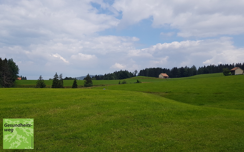
The gently rolling hills, lush greenery, villages scattered throughout all come together to form the healthy and unspoiled Appenzell landscape. This hike with its magnificent views of Vorarlberg, Lake Constance and the Allgäu is well named with the 70 or so plaques giving information on many local medicinal plants and their uses.
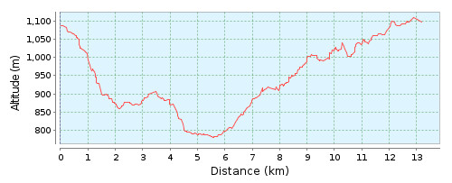
The route that I took is about 13.2km in length and you should allow about 4 hours of actual hiking time, in addition to the time spent resting and admiring the views. The Appenzellerland website splits the route into 4 shorter non-circular routes, with the fourth one running from Kaien towards Rütegg and then taking a more direct route to Oberegg, avoiding the loop out to St. Anton. Using this short cut would reduce the circular walk by about 2.5km
The Hike
Hike summary
| Date: | 25th June 2018 |
| Weather: | Mixed – initially drizzle, then overcast before becoming sunny. |
| Start time: | 09:15 |
| Hike No. | Local Route 978 |
| Length: | 13.2km |
| Ascent/Descent: | 429 / 429 |
| Hiking Time: | 4 hours |
| Grade/Fitness Level: | easy (hiking trail) / easy |
| Signposting: | The route is signposted with its own Gesundheitsweg signs on the trail signposts. |
Overview
The hike can be started pretty much anywhere on the circular route and undertaken in either direction. As I was driving, I chose to start at Gonzern in the south east of the trail as there was plenty of parking space there and to do the hike in an anti-clockwise direction. The route takes us past Oberegg, Heiden, Kaien, and St. Anton before returning to the starting point.

4,465 total views, 5 views today