Wasserfälle am Lag da Pigniu
Introduction
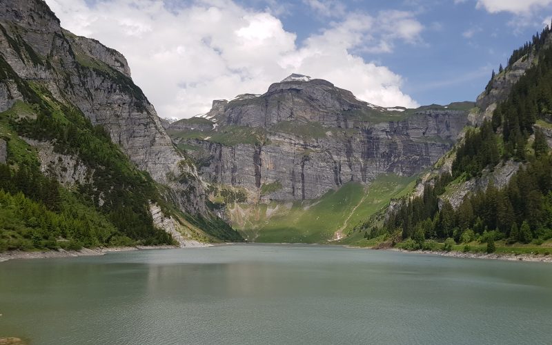
Walk through the beautiful Alpine grazing lands with their enchanting huts, up to the dam at Lag da Pigniu (Lake Pigniu), with its artistic memorial to Russian field marshal Suvorov, who, in 1799, while fleeing with his with his troops from the French army lost many soldiers, horses and supplies crossing the Panixerpass in the snowdrifts.
Follow the trail around the edge of the lake to see the romantic, high cascading waterfalls at the far end, and take a break at the firepits, before returning along the other side of the lake and back to your starting point in Andiast.
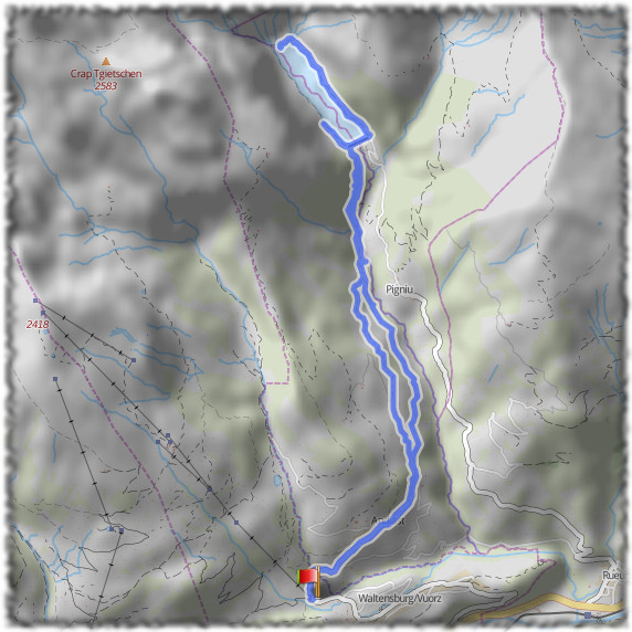
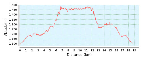
This hike is about 19km in length and you should allow about 4hrs 40 minutes of actual hiking time, in addition to the time spent resting and admiring the views.
The Hike
Hike summary
| Date: | 4th June 2018 |
| Weather: | Sunny with some clouds |
| Start time: | 09:05 |
| Hike No. | Local route 679 |
| Length: | 19km |
| Ascent/Descent: | 480 m/480 m |
| Hiking Time: | 4hrs 40 mins |
| Grade/Fitness Level: | Medium (mountain hiking trail)/Medium |
| Signposting: | Follow the signposts for trail 679 |
Overview
The hike starts by taking you along the side of the valley, through the Alpine meadows, with the huts and houses dotted throughout them. Eventually, you reach the dam at Lake Pigniu and the trail then takes you down one side of the lake at the base of the cliffs. At the far end of the lake, there is a fire pit and picnic area for your lunch, overlooking the stunning Alpine waterfall. The trail then returns down the other side of the lake, back to the dam and then returns to Andiast through the meadows.
Alternative startThere is no parking in the village of Andiast and the buses to and from the village run hourly, so unless you are travelling just by public transport, you will need to find somewhere nearby to park. I chose to park at Talstation Sesselbahn, which has a large car park, and walk from there along to roadsto the official start of trail 679 at the far end of the village (and back at the end of the hike). It added about 3km in total to the hike. The map and altitude profiles below show the entire route, including the extra parts at the start and end. |
3,487 total views, 2 views today