Lag du Pigniu dam to the waterfalls
Summary: This section of the hike was meant to take us from the Dam, along the left hand (western) side of the lake to the waterfalls and the picnic area. However, a short distance along the trail, it was blocked by a landslide that was still being removed (also, the bridge at the far end had still not been reinstated).
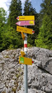 At the signpost, giving us the choice of crossing the dam to the easier eastern trail to the head of the lake, or remaining on this side, I chose the latter and followed the gravel trail as it made its way along the side of the lake at the foot of the cliff.
After a short distance, the track was covered by the remains of a landslide, with evidence that excavators had flattened it out and crossed it. As the landslide was passable, I carried on the way I was going, until I eventually reached an area where the workmen were actually still removing the blockages and the trail was unpassable.
Left with no option, I turned around and retraced my steps back to the dam and made my way across it.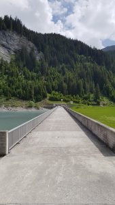
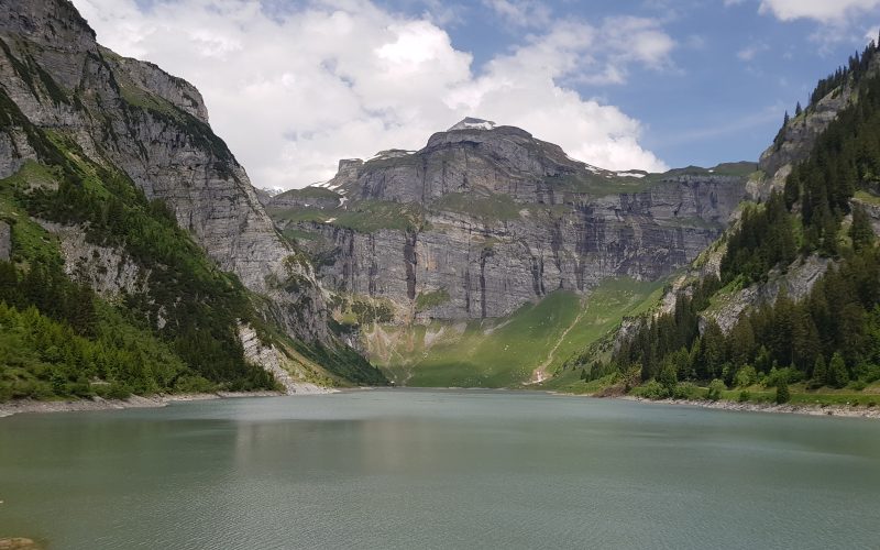
On this side of the lake, the track is much wider and open, affording wonderful views across the lake to the cliffs rising steeply from the water on the other side.
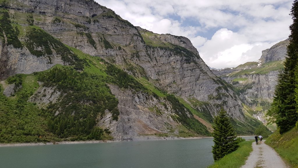
As we make our way along the track, looking over to the other side of the lake reveals the landslide that is being removed, as well as others still blocking the trail further on.
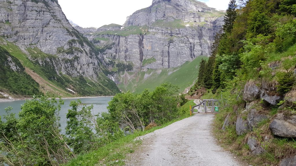
we eventually reach a fence and gate that block our path, but has a smaller gate in the middle that we can pass through.
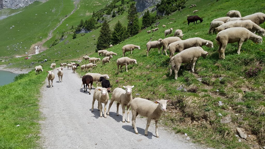
The other side of the gate is the area where sheep are roaming freely on the grassy slopes of the valley side, and (as indicated by the warning sign on the gate) are protected by livestock guardian dogs. Also evident, just beyond the gate are signs of landslides this side of the lake as well, which are being cleared away.
As the track winds its way along the side of the lake, closer and closer to the picnic area and waterfalls at the far end, we encounter a large flock of freely roaming sheep.
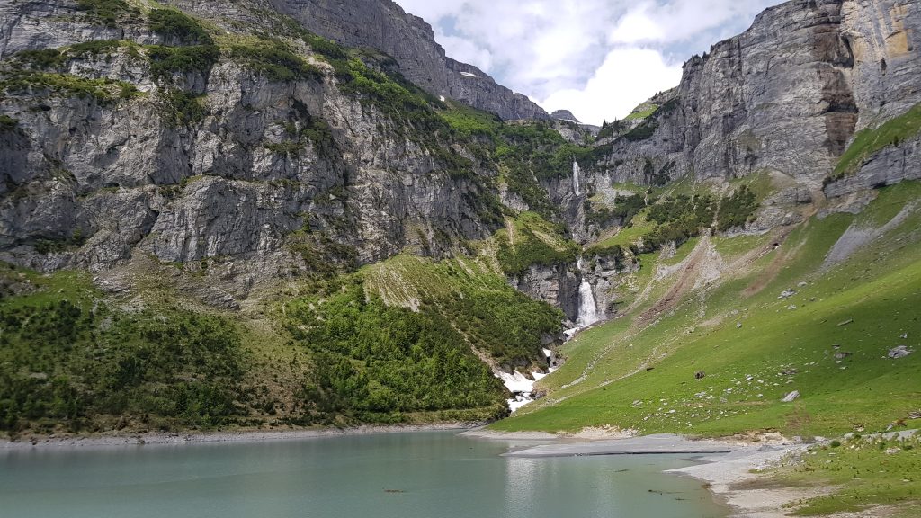
As we walk further along the track and get closer to the end of the lake, the size and majesty of the waterfalls at the end becomes apparent.
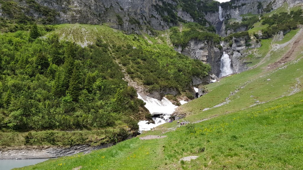
When we eventually reach the far end, there is a small picnic area with bench tables and a fire-pit. The trail carries on over a bridge above the rushing waters from the first waterfall, and around the end of the lake towards the second waterfall and the trail back down the other side of the lake. As you can just make our from the picture below, the second bridge is currently not in place.
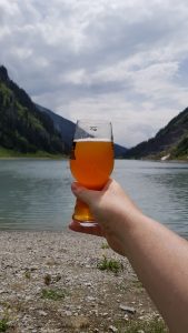
Deciding against making use of the picnic area for my lunch, I made my way down the grassy slope to the edge of the lake and the impressive view back down the lake towards the dam at the other end.
|
For lunch, I paired traditional Swiss Gruyère cheese, Tessinerbrot and a selection of cold meats with a glass of Tschlin Ambra from local brewer Bieraria Tschlin. There’s something special about enjoying a locally produced, organic beer, chilled by the same (or nearby) Alpine waters that were used to create it. Add to that the magical scenery and serenity of the Alpine waterfalls falling into the lake and it makes for a relaxing lunch break on a long hike. |
 Lunch
Lunch3,381 total views, 6 views today