Giessbachfälle Hike
Introduction
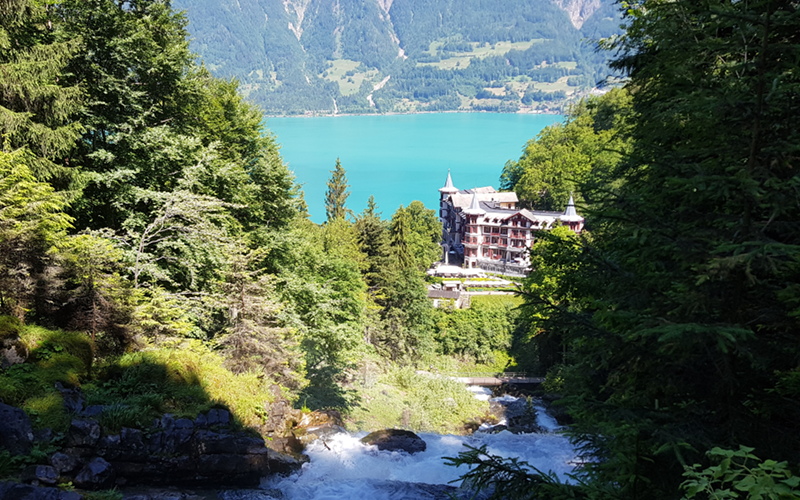
The Giessbach mountain stream falls over the imposing Giessbach Falls (Giessbachfälle), over which the water cascades in 14 steps, with over 500 m difference in height from the top to the bottom. The trail up the valley, running alongside and crossing the stream in a number of places forms the centerpiece of this hike.
In addition to the walk up the side of the stream and waterfalls, the hike also takes us down to the Brienzersee, and along the shore for a short distance as well as making its way back down from the top of the waterfall through the wooded areas above the historic Grandhotel Giessbach.
This hike is about eight and a half km in length and you should allow about 3 and a quarter hours of actual hiking time, in addition to the time spent resting and admiring the views.
The Hike
Hike summary
| Date: | 19th June 2018 |
| Weather: | Sunny |
| Start time: | 09:14 |
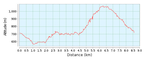
| Length: | 8.5km |
| Ascent/Descent: | 584m / 584m |
| Hiking Time: | 3hrs 15mins |
| Grade/Fitness Level: | Hiking Path (easy) / Medium |
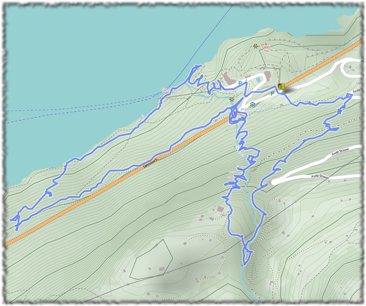
| Signposting: | Giessbachsee – Iseltwald – Giessbach Hotel – Schweibenalp – Bramisegg – Giessbach Hotel/See |
Overview
The hike starts at the public car park on the road leading down to the Grandhotel Giessbach and initially makes its way down past the hotel to the boathouse and base station of the funicular railway on the shore of the Brienzersee. The route then takes us along the shore towards Iseltwald, before turning back on itself towards the base of the waterfalls. After climbing the valley past Schweibenalp, we cross the stream a final time before making our descent past Hubel, Restaurant Bramisegg, Niuwriitiwald and Wirzi, back to our starting point
4,612 total views, 4 views today