Introduction
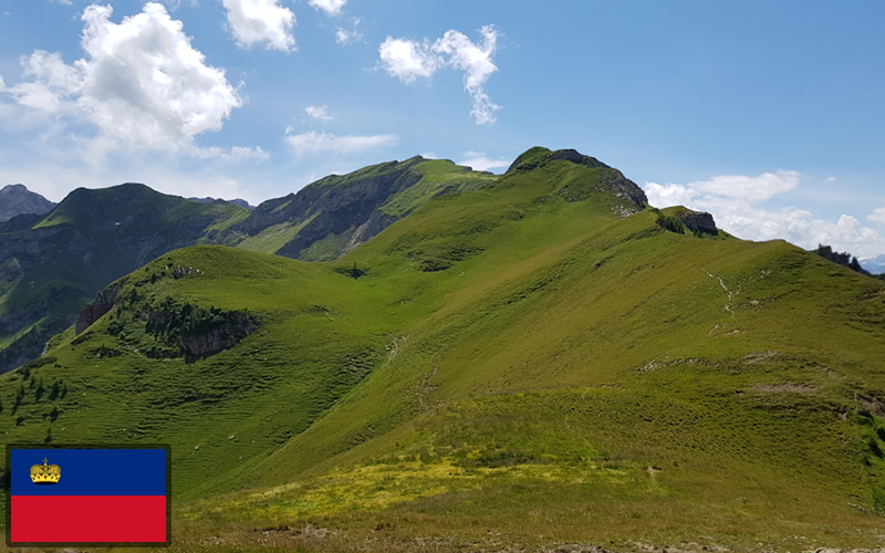
This circular hike leads along the Ridge Way to the imposing landscape to Rappenstein (2222 m), whose peak is adorned with a mighty cross. From here, all of the mountains of the Liechtenstein Alps, the Alpstein and on clear days Lake Constance as well are visible.
This hike is about 17km in length and you should allow about 6 hours of actual hiking time, in addition to the time spent resting and admiring the views.
The Hike
Hike summary
| Date: | 16th July 2018 |
| Weather: | Hot and Sunny |
| Start time: | 08:45 |
| Hike No. | Local Route 998 |
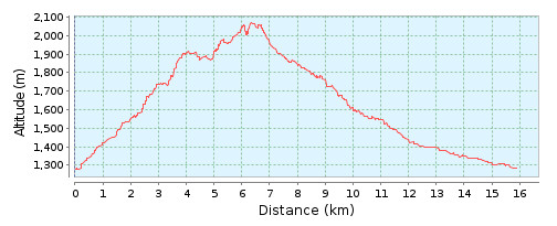
| Length: | 17km |
| Ascent/Descent: | 1150m / 1150m |
| Hiking Time: | 6h |
| Grade/Fitness Level: | Medium (mountain hiking trail) / Difficult |
| Signposting: | Steg-Sücka-Chrüppel-Rappensteinsattel-Rappenstein-Alp Gapfahl-Valünatal-Steg |
Overview
Starting in the village of Steg, the route leads up past the Berggasthaus Sücka, to Kulm, before sharply turning to the left and running along the ridge via Chrüppel, Heubüal, Kolme and Rappenstein to the summit of Rappenstein. From the summit, we retrace our route, and turn right and take a route that leads past Rappenstein, down into the valley, before following the stream back to our starting point at Steg.
Due to time constraints, I didn’t make it all the way to the summit of Rappenstein. I stopped at the Rappensteinsattel signpost. From here, to Rappenstein was given as a 20 minute hike, so with time at the summit and the return journey, it would have likely been an additional 50 minutes.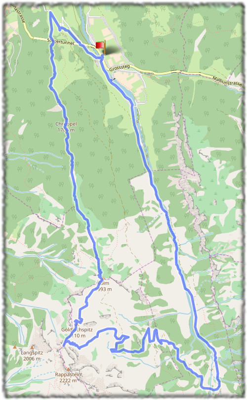
6,562 total views, 2 views today