Guscha Gratweg Hike
Introduction
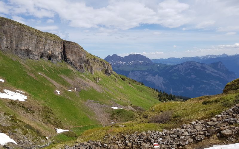
Located in the picturesque Heidiland region, this area has retained all of its original character and charm, when compared with the larger and more famous skiing and hiking resort of the Flums mountains, which is located on the opposite side of the ridge. The area is a true wonderland for nature lovers in both the summer and winter seasons. From the initial meadows and sparse forests, you soon reach the stunning moorland and Alpine scenery of Flurat/Mädems, before proceeding uphill to Chammhüttli and along the panoramic hiking trail of the ridge to Guscha summit. Along the ridge, you get a full 360° panoramic view, with the mountains of Flums to your left, the Pizol region to your right and across the valley in front of you, the Alvier chain, before descending back down the side of the ridge and back to your starting point.
This hike is about 8km in length and you should allow about 3hrs 15minutes of actual hiking time, in addition to the time spent resting and admiring the views.
The Hike
Hike summary
| Date: | 28.05.2018 |
| Weather: | Sunny with light clouds |
| Start time: | 09:45 CET |
| Hike No. | Local Route 935 |
| Length: | 8.1km |
| Ascent/Descent: | 680m/680m |
| Hiking Time: | 3hr 15m |
| Grade/Fitness Level: | Medium (Mountain hiking trail)/Medium |
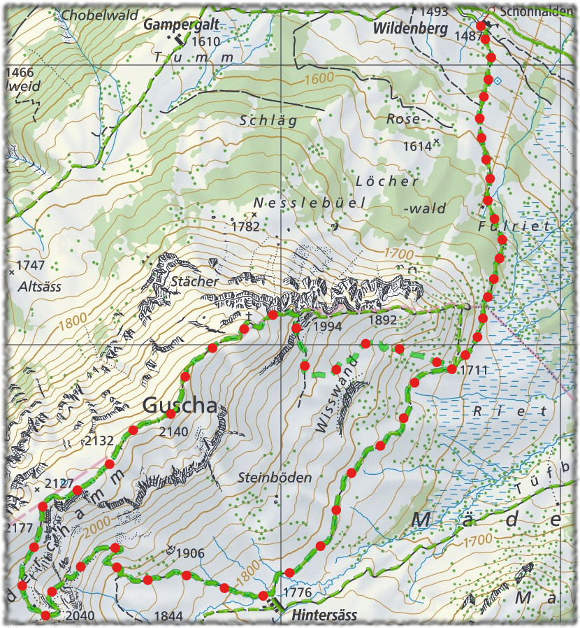
| Signposting: | Berghotel Schönhalden / Alp Wildenberg – Mädems Hintersäss – Chammhüttli – Guscha – Berghotel Schönhalden / Alp Wildenberg |
Overview
This panoramic hike starts at the summit station Flums-Kleinberg and goes through the unspoiled Alp Mädems landscape, before climbing the side of the ridge to Chammhüttli and then proceeding along the ridge via Vorderchamm to Guscha summit and then back down the side of the ridge, and back to the starting point.
4,425 total views, 4 views today