Trail Details
Mörlialp to Sandboden
Summary: This first part of the hike takes us from the start in the car park at Mörlialp, up through the woods to the actual start of the circular part of the hike, which takes us generally down hill to Sandboden.
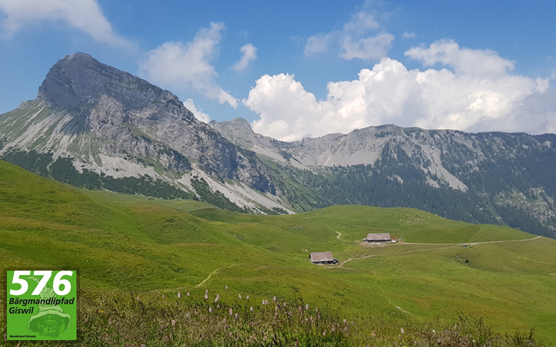
 From the trail signpost in the car park at Mörlialp, we cross over Panaoramastrasse and follow the sign marked path through the gap in the trees and onto a gravel track that leads gently up hill. As the path winds its way upwards, glimpses of Giswilerstock can be seen between the trees.
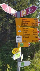
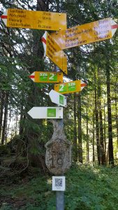
Eventually we arrive at another signpost that shows hike 576 going to the left and to the right. We will turn to our left, the trail to the right is where we will make our way from at the end of the hike. The QR code below the numbered Bärgmandli sign is one of a number on this hike, which will lead to a page on the Giswil tourism website with more information about the legend of the Bärgmandli.
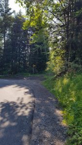 Turning to the left, the trail carries on through the woodlands as a mixture of dirt and stone, with care needing to be taken in places to avoid tripping over the exposed rocks and roots. After a while, the tarmac of Panaoramastrasse can be glimpsed through the trees and we pass another of the signposts with a Bärgmandli QR code. Crossing a small bridge and running alongside the road through the trees, the path finally moves closer to the road until it joins it and we walk a short distance along the road towards the signpost at Sandboden ahead of us.
6,206 total views, 4 views today